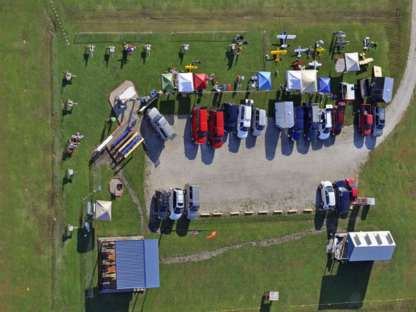
Clinton International Model Airport (CIMA)
FAA-Recognized Identification Area (FRIA)
Address
1205 East 1000 Road
Lawrence, KS 66047
38 degrees, 54' 59.7"N 95 degrees. 18' 57.6"W
38.916570 -95.315993

Maps
- Follow this link for a Google Map of Clinton Model airport.
- Follow this link for a pdf map of the airport airspace.
Directions
From Lawrence:
- Drive Clinton Parkway/23rd Street west to T-intersection at East 900 Rd., the Clinton Lake Dam Road.
- Turn left, (south) onto East 900 Road and drive 0.4 miles to East 902 Rd.
- Turn left onto East 902 Road and drive 1.9 miles to East 1000 Rd.
- Turn left (north) onto East 1000 Rd, drive past the outer parking, pass through the green gate, turn left onto the drive to our parking lot and field.
From Topeka:
- Drive east on I-70.
- Take the Lecompton exit.
- Turn right (south) onto the South Lawrence Traffic Way/K10 and drive 3.5 miles
- Turn right on the Clinton Parkway exit.
- Turn right onto Clinton Parkway.
- Drive 500 ft. to the T-intersection East 900 Road, the Clinton Lake Dam Road.
- Turn left onto East 900 Road and drive 0.4 miles to East 902 Road.
- Turn left onto East 902 Road and drive 1.9 miles to East 1000 Rd.
- Turn left onto East 1000 Rd, pass through the green gate, turn left onto the drive to our parking lot and field.
From Kansas City:
- Take K-10 west to Lawrence
- Exit K-10 at Clinton Parkway exit
- Turn left (west) onto Clinton Parkway
- Drive 500 ft. to T-intersection at East 900 Rd., the Clinton Lake Dam Road.
- Turn left, (south) onto East 900 Road and drive 0.5 miles to East 902 Rd.
- Turn left onto East 902 Road and drive 1.9 miles to East 1000 Rd. You will pass the entrance to Eagle Bend Golf Course at 0.9 miles.
- Turn left (north) onto East 1000 Rd, drive past the outer parking, pass through the green gate, turn left onto the drive to our parking lot and field.


